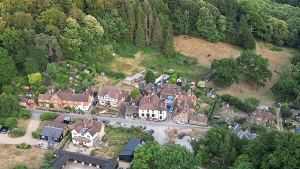
Welcome to the community web-site of Coldharbour located 4 miles south-west of Dorking in the Surrey Hills National Landscape. At 750 feet above sea level, Coldharbour is the highest community in the south of England with extensive views and open access land on all sides managed by the National Trust, Forestry England and the Wotton Estate. It is an area which is very popular with hikers and bikers on a vast network of public footpaths, bridleways and byways.
A byway opposite the Plough Inn and Shop leads up to the sports pavilion and beyond to the top of Leith Hill with its tower and servery. There are large car-parks around the hill on Abinger Road and Leith Hill Road with foot-paths signposted up to the tower.
The western end of the village has Christ Church, the John Venus Hall and the Memorial Ground with a children's playground and has southerly views across the Sussex Weald to the South Downs National Park. The eastern end has northerly views to the North Downs ridge and contains the site of the registered ancient monument Anstiebury Camp Hillfort. Half a mile down Anstie Lane the route of the roman road Stane Street crosses near Bearehurst.
The village has around 240 residents and is served by Capel Parish Council and Mole Valley District Council. The village centre was designated as a conservation area in 1975, view a map of the area here.
To contact the webmaster or to have your details on the village email list please email.
Our web-site platform hosts provide the Privacy Policy which governs all users of this web-site.